Email: sales@gnsspcb.com Tel: pls email us
Email: sales@gnsspcb.com Tel: pls email us

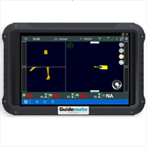
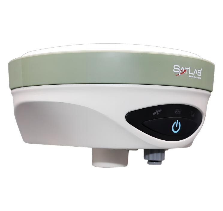
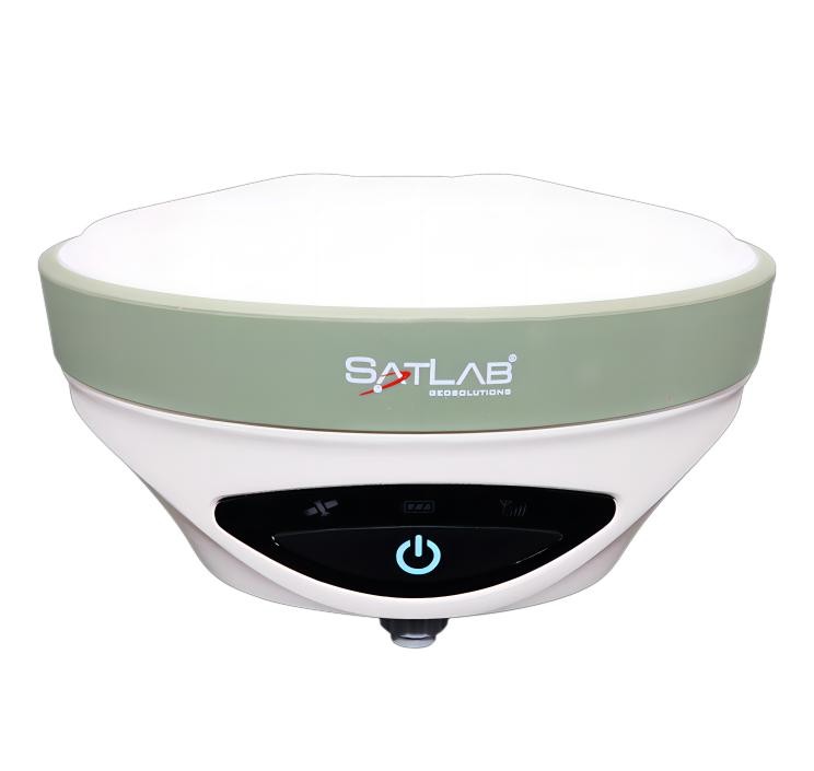
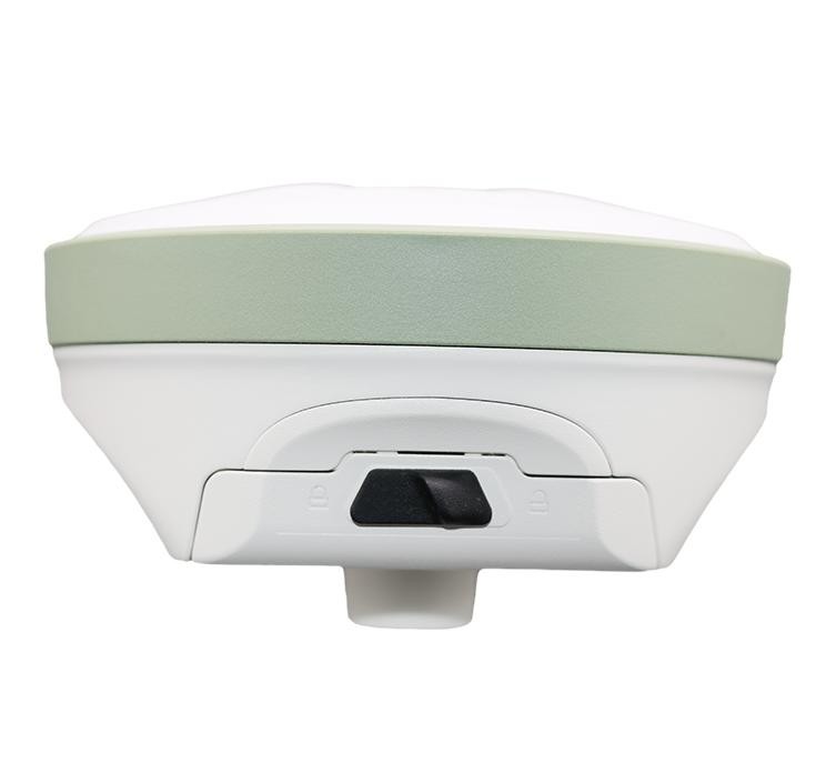
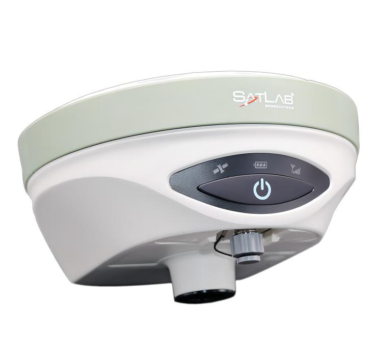
Home Products Survey Smart Antenna SatLab SL900
| GNSS features | Channels | 1760 |
| GPS | L1C/A, L1C, L2C, L2P, L5 | |
| GLONASS | L1C/A, L2C/A, L2P, L3CDMA | |
| BDS | B1I, B1C, B2I, B2a, B3 | |
| GALILEO | E1, E5A, E5B, E5AltBOC, E6 | |
| SBAS | EGNOS, WAAS, GAGAN, MSAS, SDCM(L1,L5) | |
| QZSS | L1C/A, L1C, L2C, L5, L6 | |
| Navic | L5 | |
| On module L-Band | Reserve | |
| Positioning output rate | 1Hz~20Hz | |
| Initialization time | 2-8 s | |
| Initialization reliability | > 99.9% | |
| Positioning precision | Code differential GNSS positioning | DGPS/RTCM |
| Static(long observations) |
Horizontal: 2.5 mm + 0.1 ppm RMS Vertical: 3.5 mm + 0.4 ppm RMS |
|
| Static |
Horizontal: 2.5 mm + 0.5 ppm RMS Vertical: 3.5 mm + 0.5 ppm RMS |
|
| Rapid static |
Horizontal: 2.5 mm + 0.5 ppm RMS Vertical: 5 mm + 0.5 ppm RMS |
|
| PPK |
Horizontal: 8 mm + 1 ppm RMS Vertical: 15 mm + 1 ppm RMS |
|
| RTK(UHF) |
Horizontal: 6 mm + 0.5 ppm RMS Vertical: 10 mm + 1 ppm RMS |
|
| RTK(NTRIP) |
Horizontal: 8 mm + 0.5 ppm RMS Vertical: 15 mm + 0.5 ppm RMS |
|
| RTK initialization time | 2 ~ 8s | |
| SBAS positioning |
Horizontal: 50cm RMS Vertical: 85cm RMS |
|
| L-BAND |
Horizontal: 5-10cm (5-30min) Vertical: 10-30cm (5-30min) |
|
| IMU | Less than 10mm + 0.7 mm/° tilt (2.5cm accuracy in the inclination of 30° ) | |
| IMU tilt angle | 0° ~ 60° | |
| User interaction | Operaing system | Linux |
| Start Up Time | 3 s | |
| Hardware performance | Dimension |
170 mm x 95 mm
|
| Weight | 1.2 kg including battery | |
| Operating temperature | -25°C~+65°C | |
| Storag temperature | -40°C~+80°C | |
| Waterproof/Dustproof |
IP67 environmental protection
Waterproof to 1m (3.28ft) depth
Temporary Submersion
|
|
| Shock and vibration |
Shock resistant body to 2 m (6.5ft) pole drop Shock and vibration: MIL-STD-810 G, 514.6 |
|
| Battery |
Battery: 5,000 mAh Lithium-Ion Battery
|
|
| Battery life |
10 hours (RTK Rover) |
|
| Communication | 4G |
Internal 4 G Mobile Network
TDD-LTE/FDD-LTE/WCDMA/GPRS/GSM
NTrip Enabled
|
| Bluetooth |
Bluetooth: V2.1 + EDR, NFC |
|
| WIFI |
Wi-Fi: 2.4 G ,802.11 b/g/n Mini USB |
|
|
Internal Radio |
403MHz~473MHz | Typically 5km, optimally 8-10km
1- 4 W , Support HI-TARGET, TRIMTALK450S,
TRIMMARK III, TRANSEOT, SATEL-3AS, etc..
|
|
| Data storage/ Transmission | Storage |
Circulating 8 GB Internal Storage;
Supports 32 G SD card
|
| Data transmission |
Plug and play mode of USB data transmission Supports FTP/HTTP data download |
|
| Data format |
CMR, CMR+, RTCM2.X, RTCM3.0, RTCM3.2
GNS, Rinex
|
|
| Sensors | Electronic bubble | Controller software can display electronic bubble, checking leveling status of the carbon pole in real-time |
| IMU | Built-in IMU module, calibration-free and immue to magnetic interference | |
| Thermometer | Built-in thermometer sensor, adopting intelligent temperature control technology, monitoring and adjusting the receiver temperature |
Items marked with * will be upgraded along with the update of assigned firmware The data comes from the SOUTH GNSS Product Laboratory, and the specific situation is subject to local actual usage.